[Back to Narrabri Weather Home Page]

Narrabri Supercell on 27 September 2006


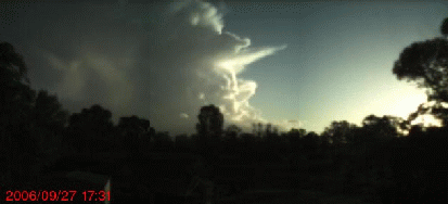
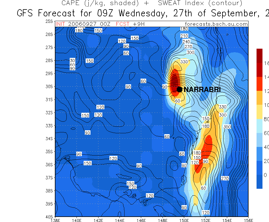
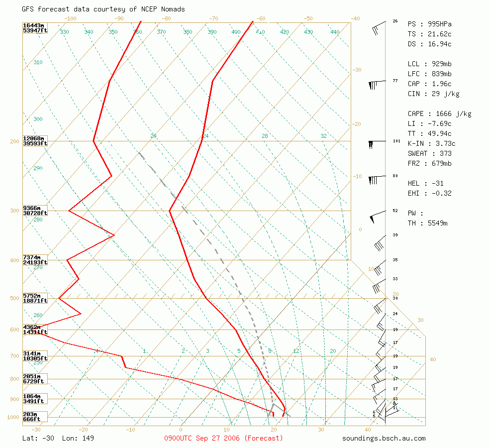
On Wednesday 27th September Narrabri (NSW, Australia) awoke to the sound of thunder and a welcome 5-10mm of rain as a trough moved in from the west. At 12:25pm the Bureau issued a severe thunderstorm warning for the area. Several large cells moved through, including one north of Wee Waa. There was severe storm activity NE of Moree. By 16:00 cells with strong updrafts could be seen developing SW of Narrabri, strongly interacting with the winds aloft.

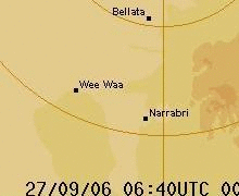
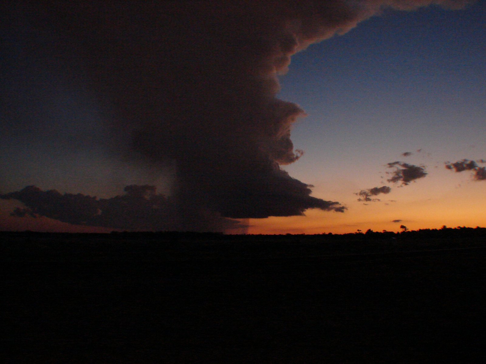
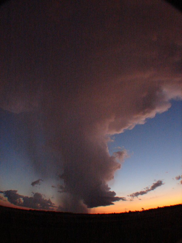
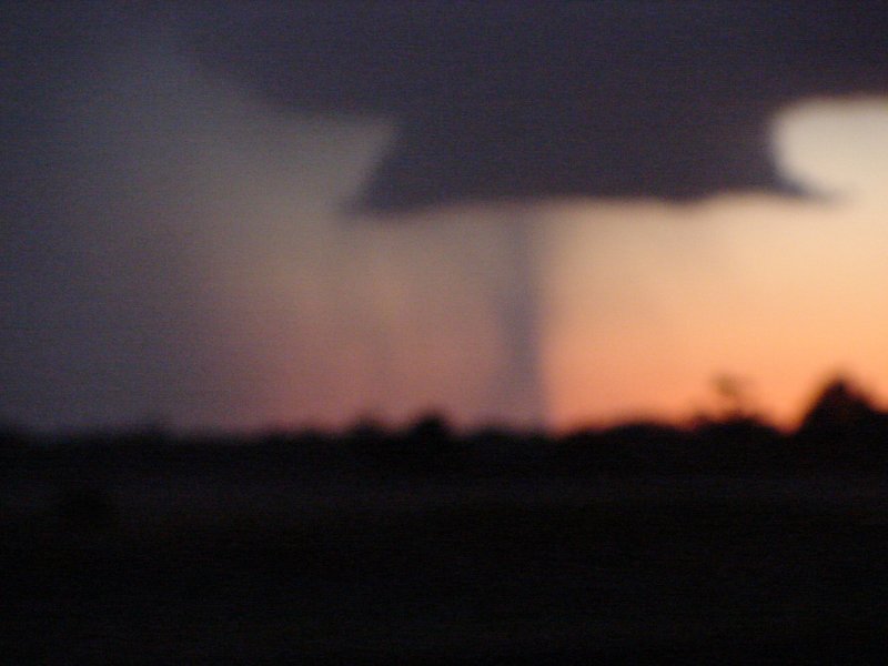
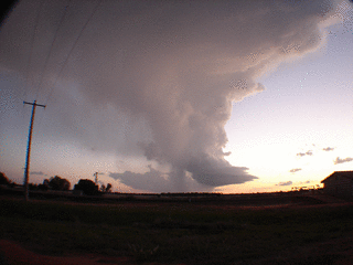
As the cell approached Narrabri it seemed to split, you can see this on the Bureau of Meterology RADAR loop. The left-moving part showed clear rotation. This little Low Precipitation (LP) supercell soon developed a very nice circular wall cloud towards the rear of the inflow, but then the whole storm rapidly dissipated after sunset.

James also has also written a storm report and even has some great photos of this same storm here.

For about 10 minutes there was a faint persistent structure between the wall cloud and the ground, shown in some of the photos below. We asked some of the experts from Australian Severe Weather if it might have been a weak tornado, since this is exactly where you would expect to find one:

  • Michael Bath contributed "It's very difficult for LPs to produce a tornado with the bases high compared to other supercells, although larger LPs certainly can. Low level shear needs to be a lot stronger too - note the sounding has shear at about 15 - 20 knots until a fair way up. You need 35knot or more but there are no set rules !"
  • Jimmy Deguara indicated "It does seem the storm did have rotation but I cannot see any tornado - looks rainshaft to me." Maybe next time...


    It's not often that you can see all storm features as clearly as this, since there is usually a flanking line and more precipitation around to obscure the view. Photo from Culgoora silos by Chris Allen. Very nice photo of the storm at sunset. Photo from Culgoora silos by Chris Allen.
    An impressive lowering developed beneath the cell as it reached maximum intensity. Photo from Culgoora silos by Chris Allen. Longer exposure of the storm. Photo from Culgoora silos by Chris Allen.
    Very nice wide-angle shot showing the storm inflow, updraft and anvil. Photo from Culgoora silos by Chris Allen. Cool sunset shot of mammatus clouds looking to the east from Culgoora silos. Photo by Chris Allen.
    This was the feature we thought may be a weak tornado but was probably just a rain shaft. Unfortunately the wide-angle lens meant these close-ups came out blurry. Photo from Culgoora silos by Chris Allen. More of the same. Photo from Culgoora silos by Chris Allen.


    VIEW SUPERCELL MPEG - Windows CODEC
    This MPEG (short preview on left) shows a time-lapse movie of the same cell as seen from Narrabri. You may need to grab this CODEC if it doesn't work.

    The camera was looking SW from Narrabri, so you can really only see the mid-level of the updraft. However the rotation is still quite obvious, especially towards the end of the movie. By David Brodrick and Chris Allen.


    The forecast CAPE for the relevant area ranged from about 1000 to 1600 j/kg and there was moderate wind shear.

    These graphics rendered by the awesome online tools of The Brisbane Storm Chasers Homepage.