 The 2006 winter/spring were one of the driest on record. The first major fire
near Narrabri was the Paleroo Fire, near Mt
Kaputar, there were also many other bushfires raging in the state. The first
fire in the Pilliga
Forest started after a thunderstorm on Tuesday 28th November. Lightning
from this storm ignited several fires. The following day was 42 degrees with
60km/h wind gusts. It had been 25 days since the last rain... in these
conditions the fires just exploded and burned out 100,000 hectares of bushland
in their first day. Widespread destruction of koalas and other wildlife was
reported, however an NPWS press release said the fires skirted the largest koala
colonies in the Pilliga Nature Reserve.
The 2006 winter/spring were one of the driest on record. The first major fire
near Narrabri was the Paleroo Fire, near Mt
Kaputar, there were also many other bushfires raging in the state. The first
fire in the Pilliga
Forest started after a thunderstorm on Tuesday 28th November. Lightning
from this storm ignited several fires. The following day was 42 degrees with
60km/h wind gusts. It had been 25 days since the last rain... in these
conditions the fires just exploded and burned out 100,000 hectares of bushland
in their first day. Widespread destruction of koalas and other wildlife was
reported, however an NPWS press release said the fires skirted the largest koala
colonies in the Pilliga Nature Reserve.
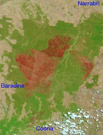
The largest fire to the south-west of the forest was called the Pilliga 4 and burned out over 92,000 Ha, the time-lapse left shows this fire. Another fire in the east of the forest was called the Kerringle fire and consumed over 23,000 Ha.
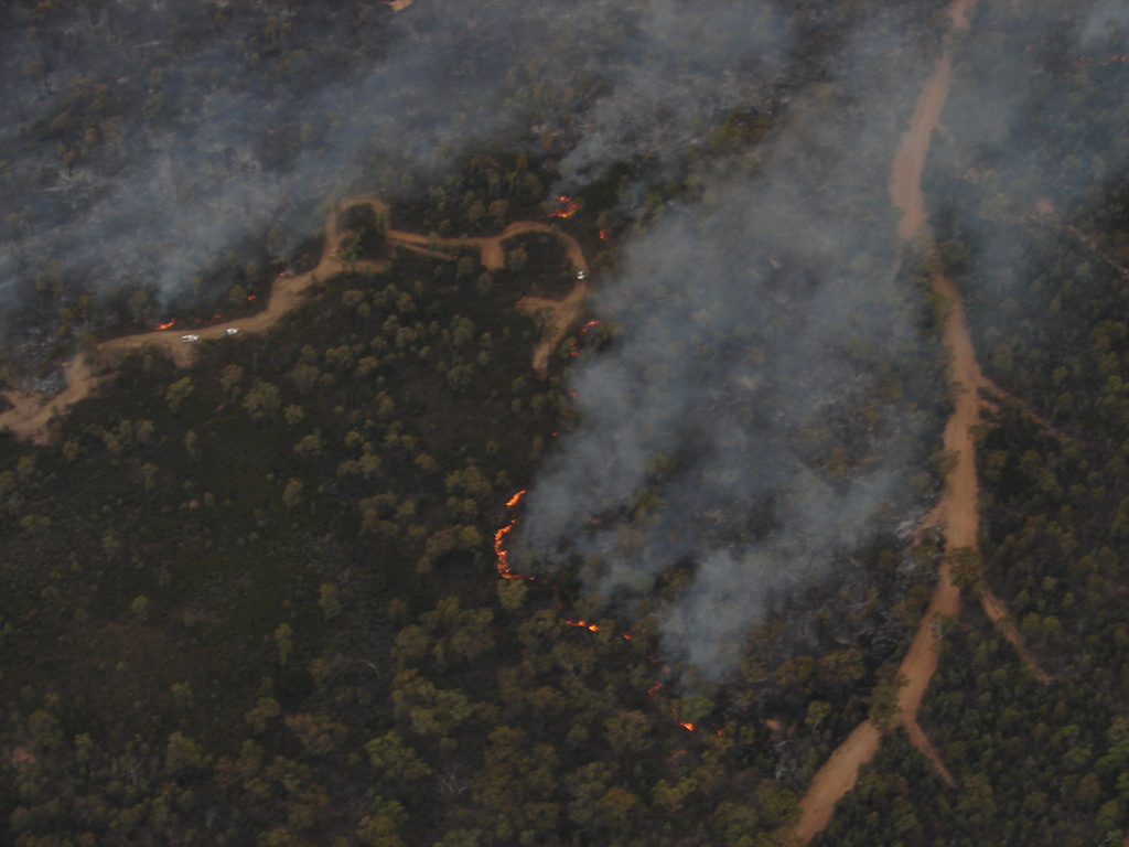
Just as the first fires were finally contained and blacked out along the perimeter, thunderstorms on the 12th and 13th of December started a number of new fires in the forest. One of these was the Goldmine Road Fire in the north of the forest, which burned out 28,000 Ha before being contained. We have some aerial photographs of this fire below. On the 12th of January 2007 another fire, the 'Kings Rd Fire', was ignited by storms but it burned a 'mere' 3000 Ha of forest before being quickly contained by the RFS, helped by heavy rainfall.
At the peak, 200 personnel from RFS, NPWS, Forests NSW, a Queensland strike team and some 17 aircraft were involved in combating the fires.
Aerial Photos
 | Fire fighters in action on the Goldmine Rd Fire on the 14th of December. By Chris Allen. | 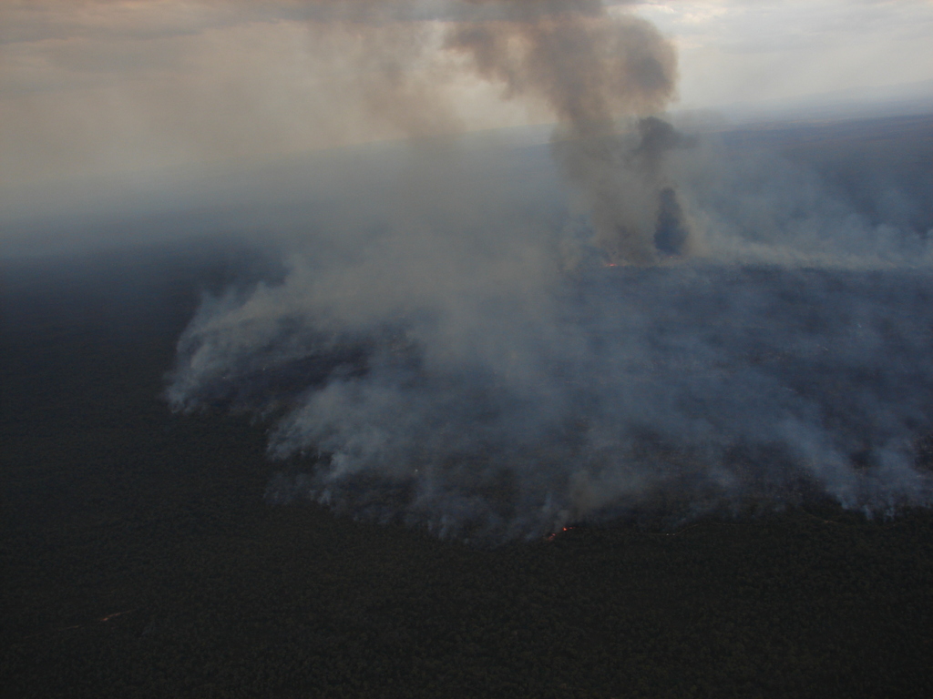 |
Active fire front on the Goldmine Rd Fire on the 14th of December. By Chris Allen. |
 |
Active fire front on the Goldmine Rd Fire on the 14th of December. By Darin Hodgson. | 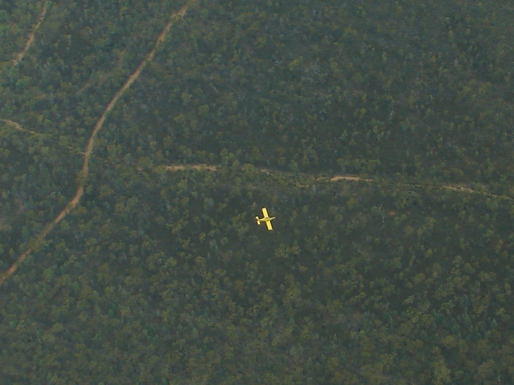 |
Photo of an RFS water bomber outbound on a sortie, taken from 6000 feet. By Chris Allen. |
On Thursday 14th December we chartered a plane from Kaputar Aviation to inspect the Goldmine Rd Fire which had been explosively active during the morning, when winds in the area were averaging 25-30km/h and gusting to 70km/h. Fortunately by 3pm the wind had dropped to less than 10km/h, and the temperature was a mild 34 degrees which helped to slow the fire down. When we flew over at 6pm, the fire was in the quiet phase but still actively burning as you can see.
Satellite Photos
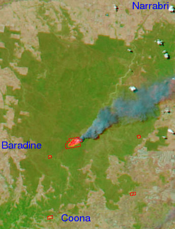 | 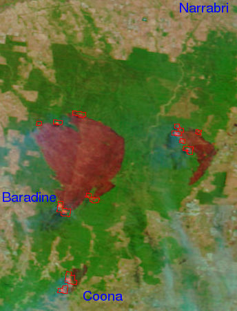 |
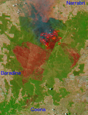 |  |
Other Photos
 |
Lightning strikes in the forest from the storm on the 28th November. By Chris Allen. | 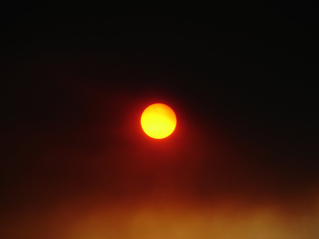 | The sky was blackened in Narrabri by 6pm on the 29th November. People reported ash falling in town later in the night. By Chris Allen. |
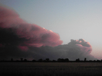
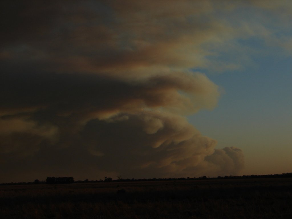 | Smoke cloud viewed from the Yarrie Lake Rd at 7:30pm on the 29th November. People reported ash falling in town later in the night. By Chris Allen. | 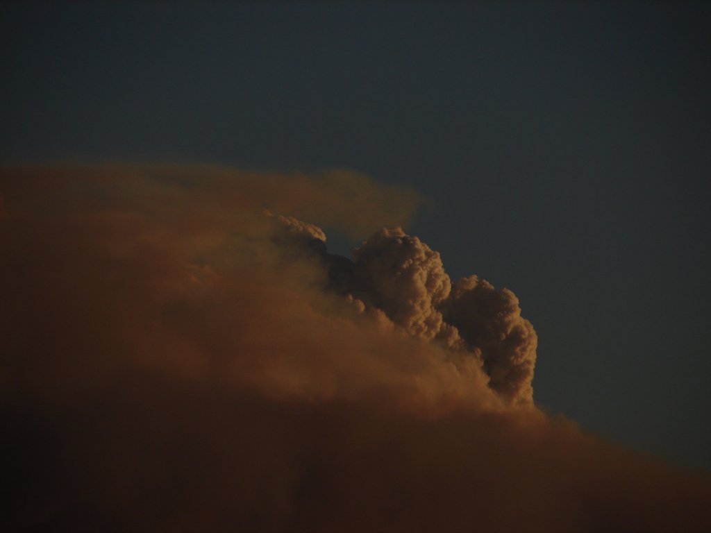 | Towering pyrocumulus on the 29th November. By Chris Allen. |
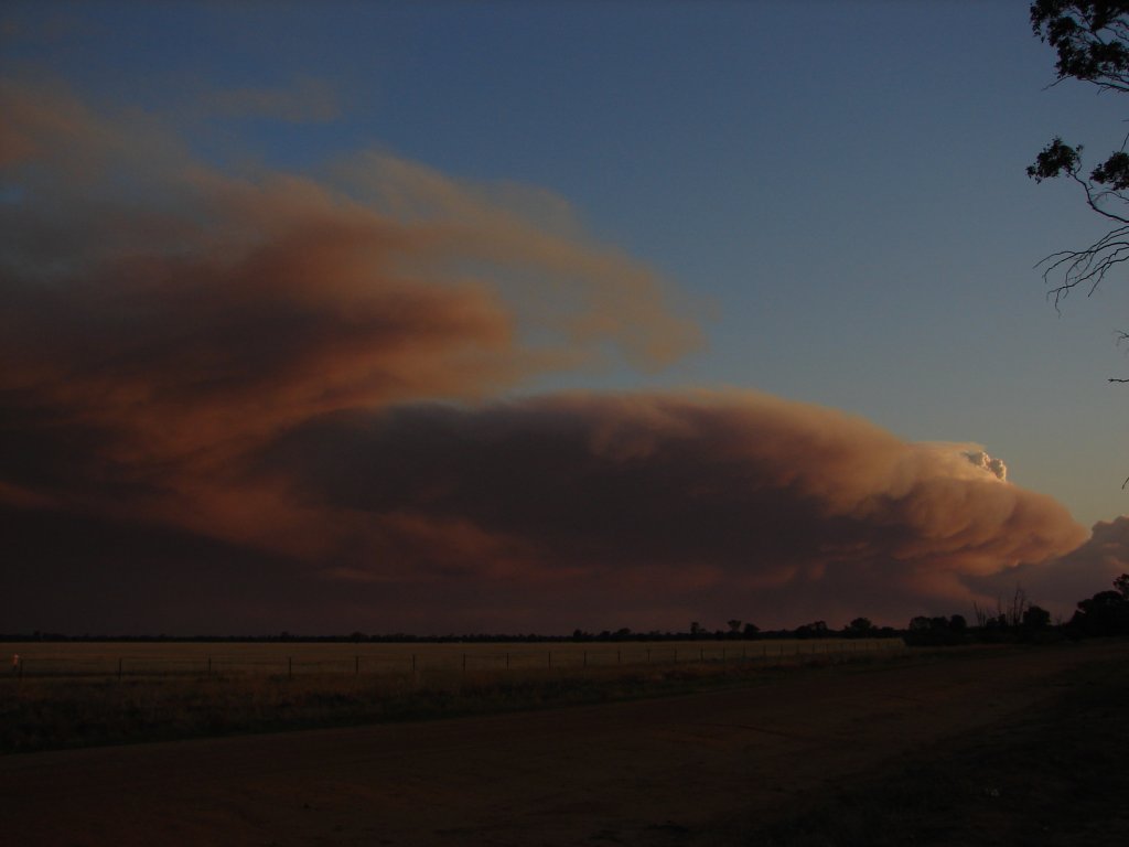 | Wide angle shot of the smoke from near Brigalow Ck on the 29th November. By Chris Allen. |  | As you can see, the fire just exploded under the hot, windy conditions. By Chris Allen. |
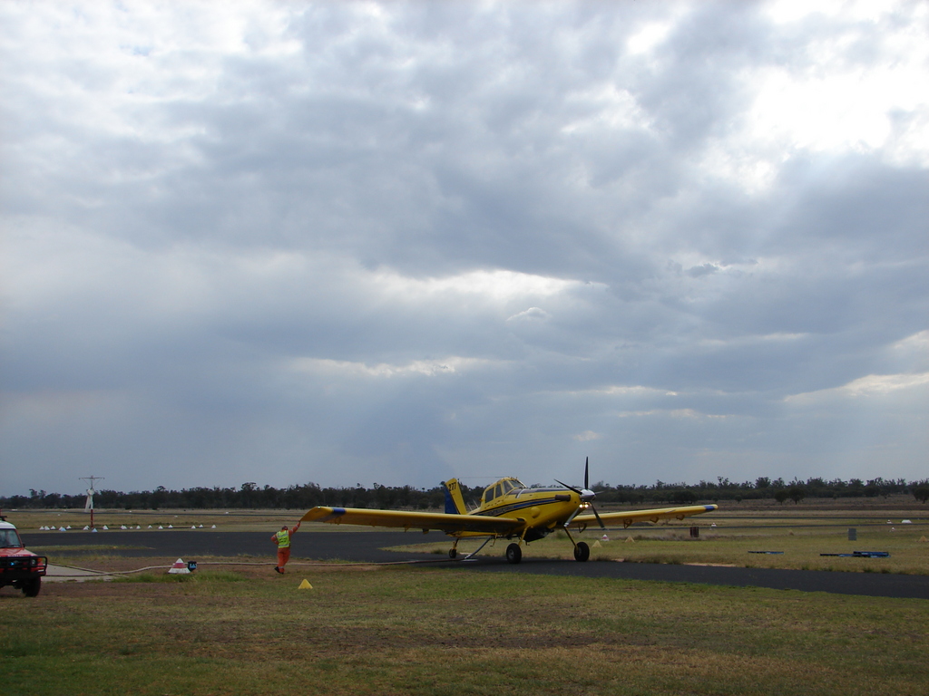 | An RFS water bomber retanking at Narrabri Airport on December 14. A large number of fixed wing aircraft were active fighting fires ignited during electrical storms the previous two nights. By Chris Allen. |  |
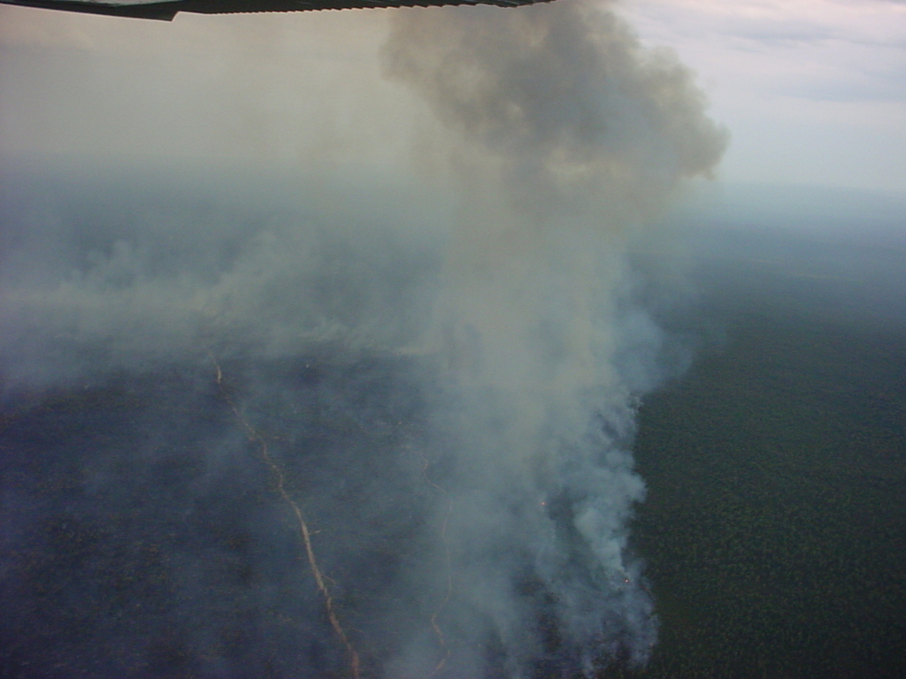
Pyrocumulus from the Goldmine Rd fire on the 15th of December. By Chris Allen. |
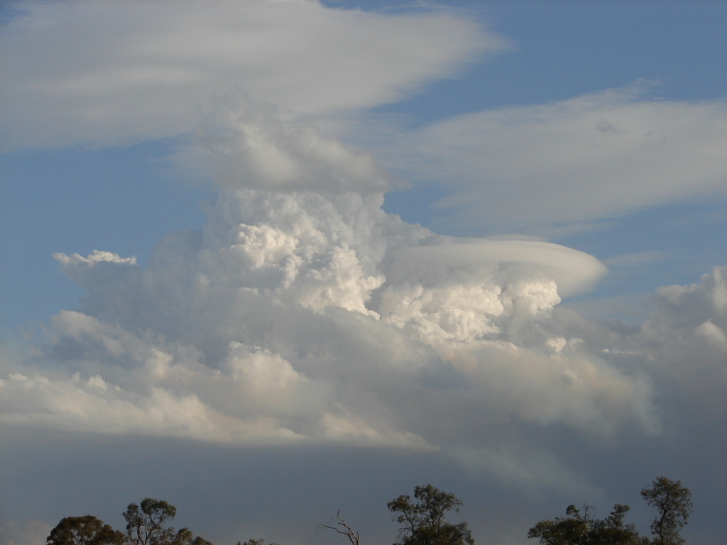 | Great photo of pyrocumulus with a lenticular cap from the Goldmine Rd fire on the 15th of December. By Chris Allen. | 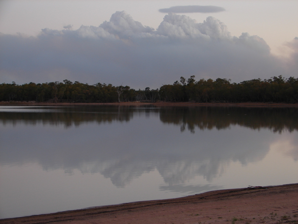 |
Pyrocumulus and smoke from the Goldmine Rd fire on the 15th of December, taken at Yarrie Lake. By Chris Allen. |
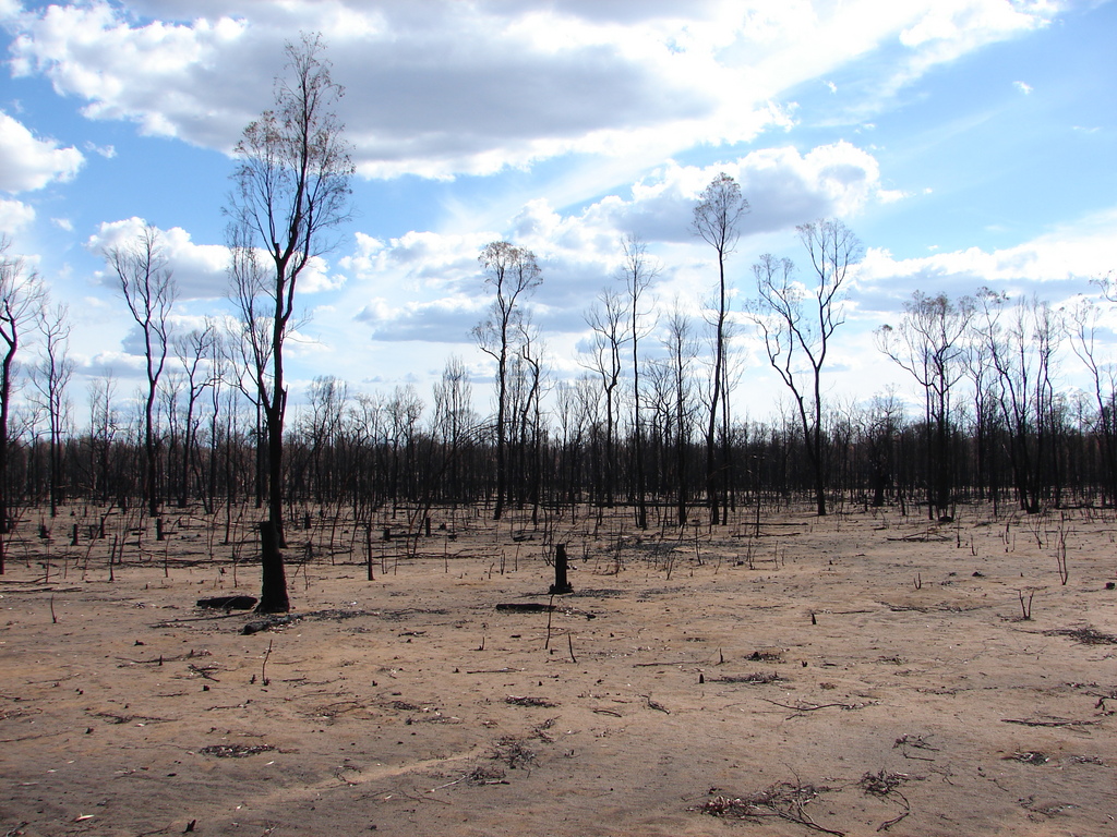 | View from 20 Foot Rd where the Goldmine Rd fire raged. Notice how the ground is completely devoid of cover apart from the occasional charred stump. Taken on the 6th of January 2007 by Chris Allen. | 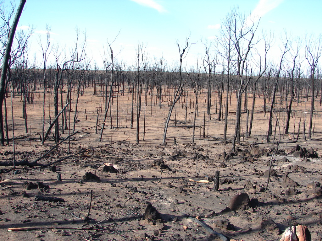 |
Destruction from the Pilliga 4 fire, from Baradine Rd about 6km from the Salt Caves. Taken on the 6th of January 2007 by David Brodrick. |
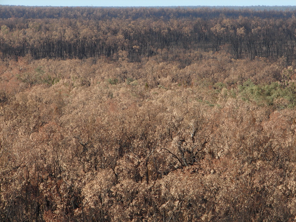 | The destruction of the Pilliga 4 fire extended as far as the eye could see. Where the fire was more intense the canopy was completely consumed, while in other places the heat from the fire below was still enough to kill the leaves. Taken near the Salt Caves on the 6th of January 2007 by Chris Allen. | 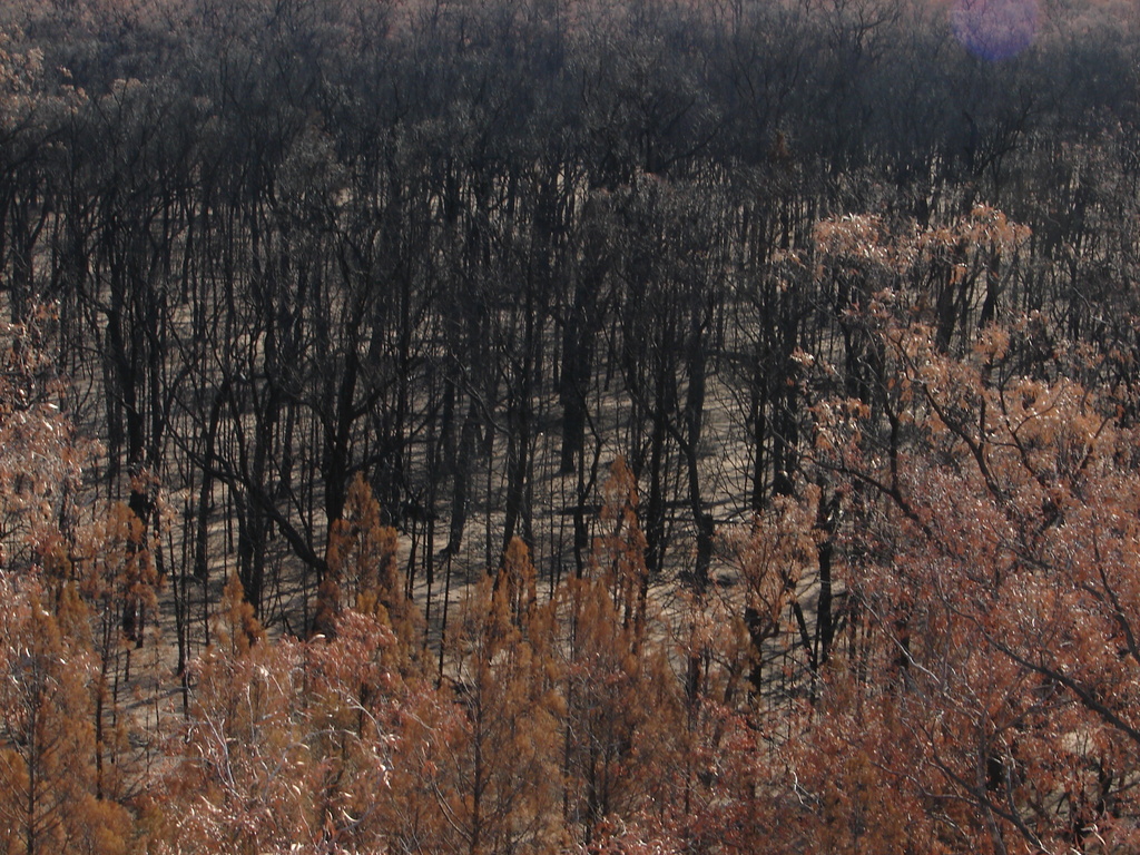 | Closeup of an area where the canopy was completely consumed. Taken near the Salt Caves on the 6th of January 2007 by Chris Allen. |
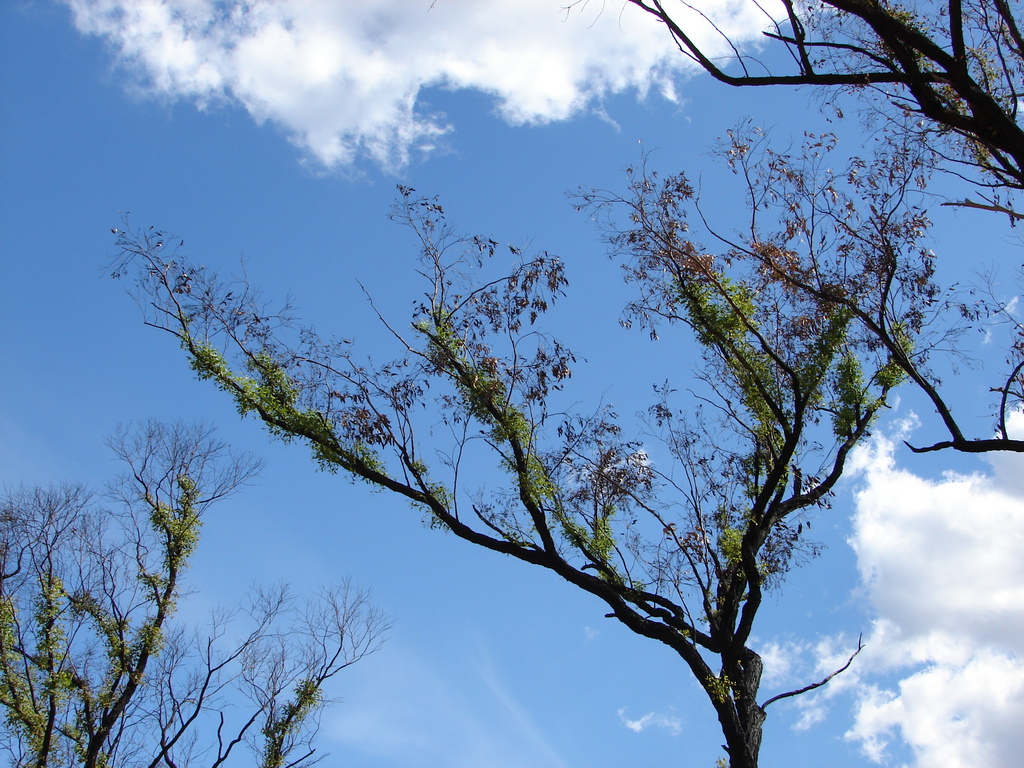 |
Epicormic shoots already covered some of the eucalypts. In other cases, where the trunk was completely killed, new stems could be seen shooting from the ground (lignotuber). Taken on 20 Foot Rd on the 6th of January 2007 by Chris Allen. | 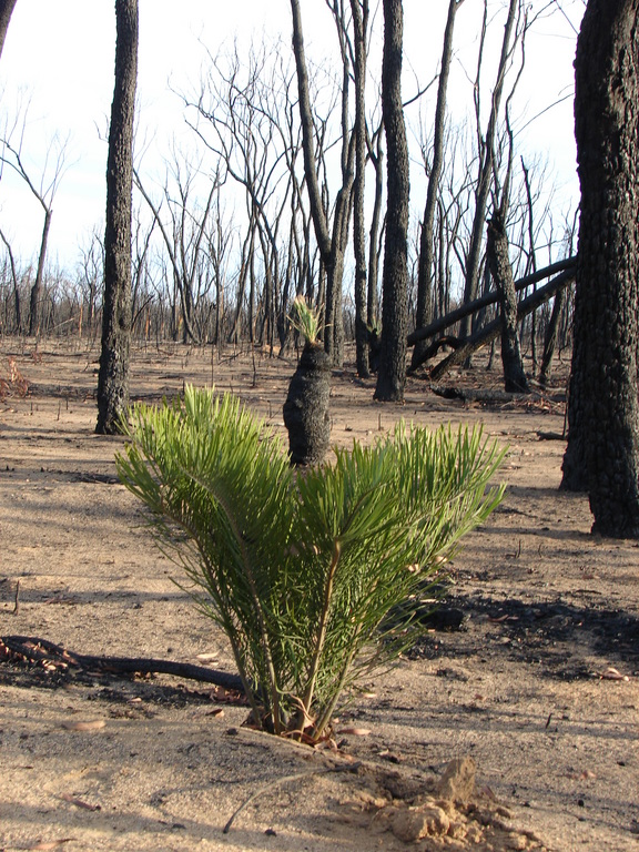 | Black boys and cycads were the first plants to recover. This is pretty amazing regrowth considering it was only a month since the fire! It's little wonder cycads have remained unchanged since the age of the dinosaurs. Taken on Burma Rd on the 6th of January 2007 by David Brodrick. |
Panoramas
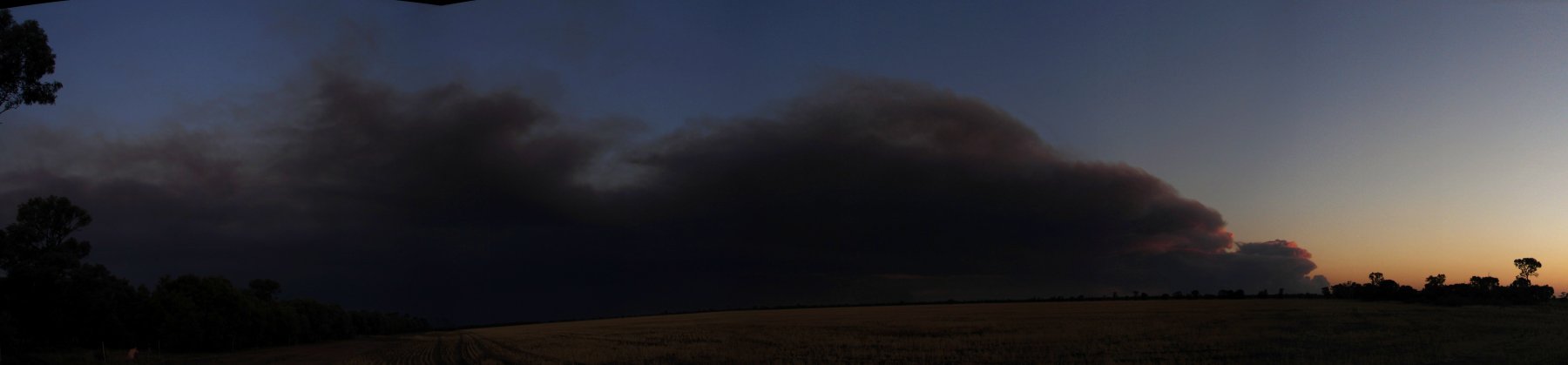
Panorama of the smoke from the Pilliga 4 fire taken on the 29th of November near Brigalow Ck. By Chris Allen.
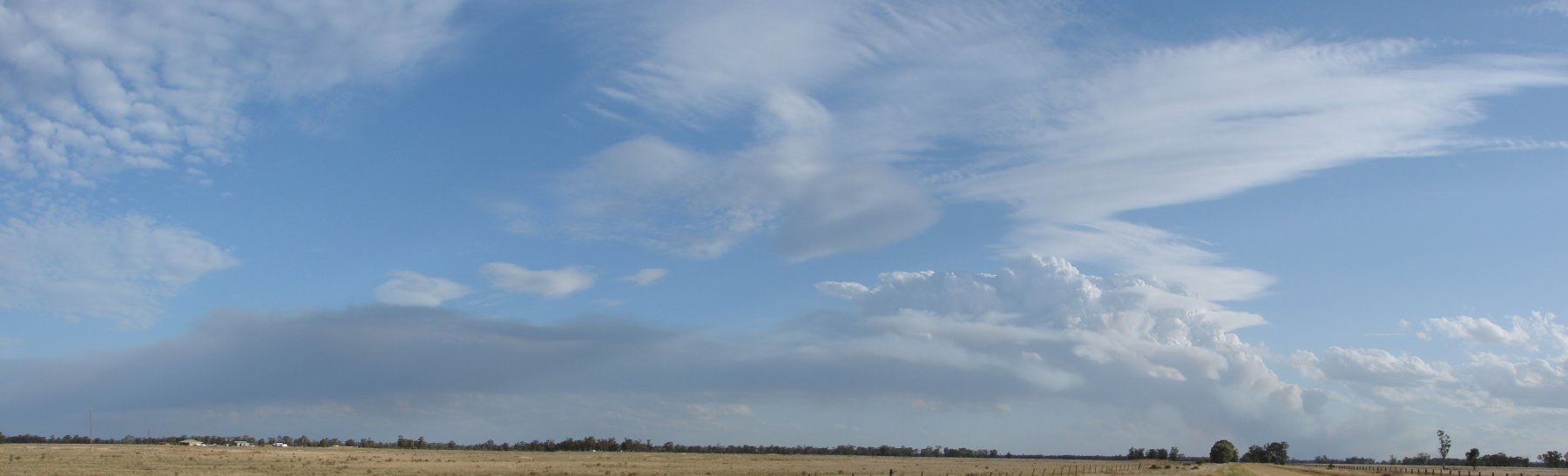
Panorama of the smoke from the Goldmine Rd fire on the 15th December, taken from the Yarrie Lake Rd. By Chris Allen.
Panorama of the smoke from the Goldmine Rd fire on the 15th December, taken from Yarrie Lake. By Chris Allen.