 |
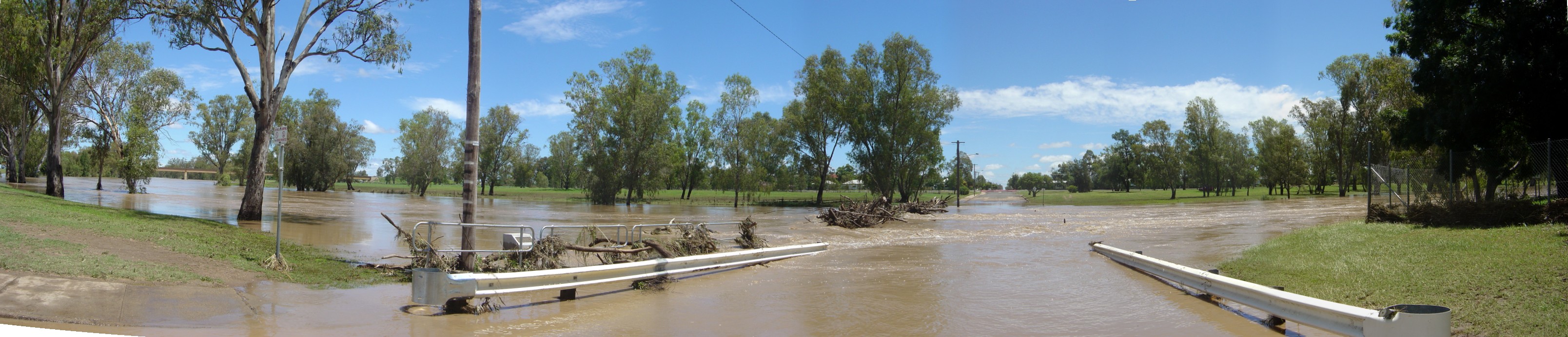
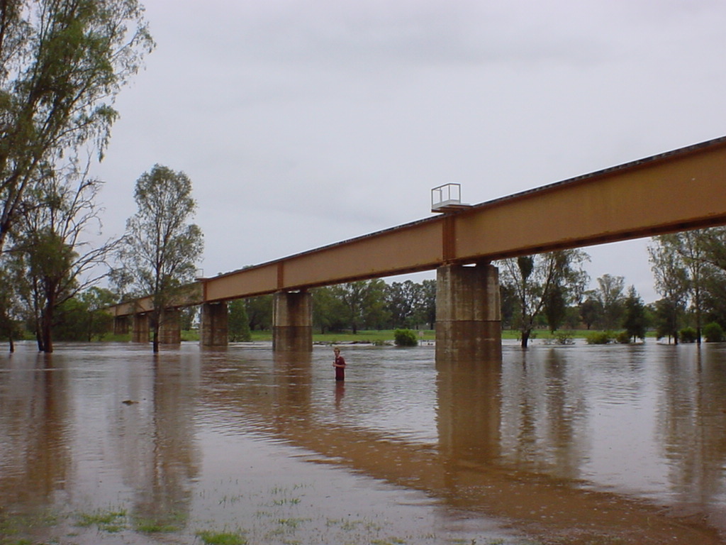
| Panorama of the floodwater taken from the big bridge. By John Giovannis. |
 |
| Panorama of debris piling up against the low-level bridge. By John Giovannis. |
 | Nuable creek on the Yarrie Lake Road. There was too much water for the culverts under the road to manage. The creek backed up until it started flowing across the road. Within a few hours it had washed out the sandy road-base, leaving the crossing impassable. Photo by Derek Aboltins. | 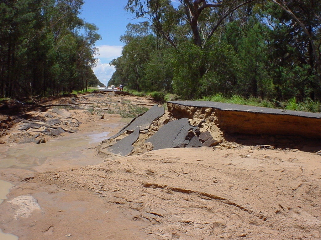 |
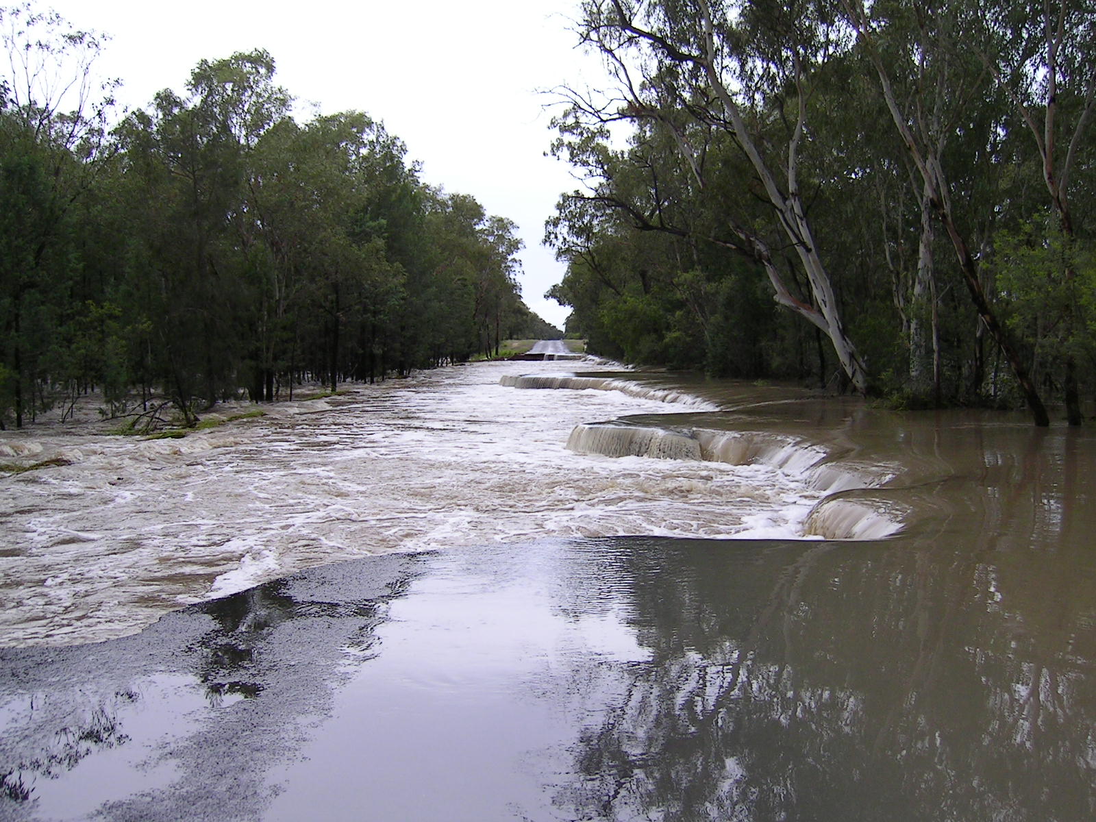
Nuable creek on the Yarrie Lake Road. Photo by David Brodrick. |
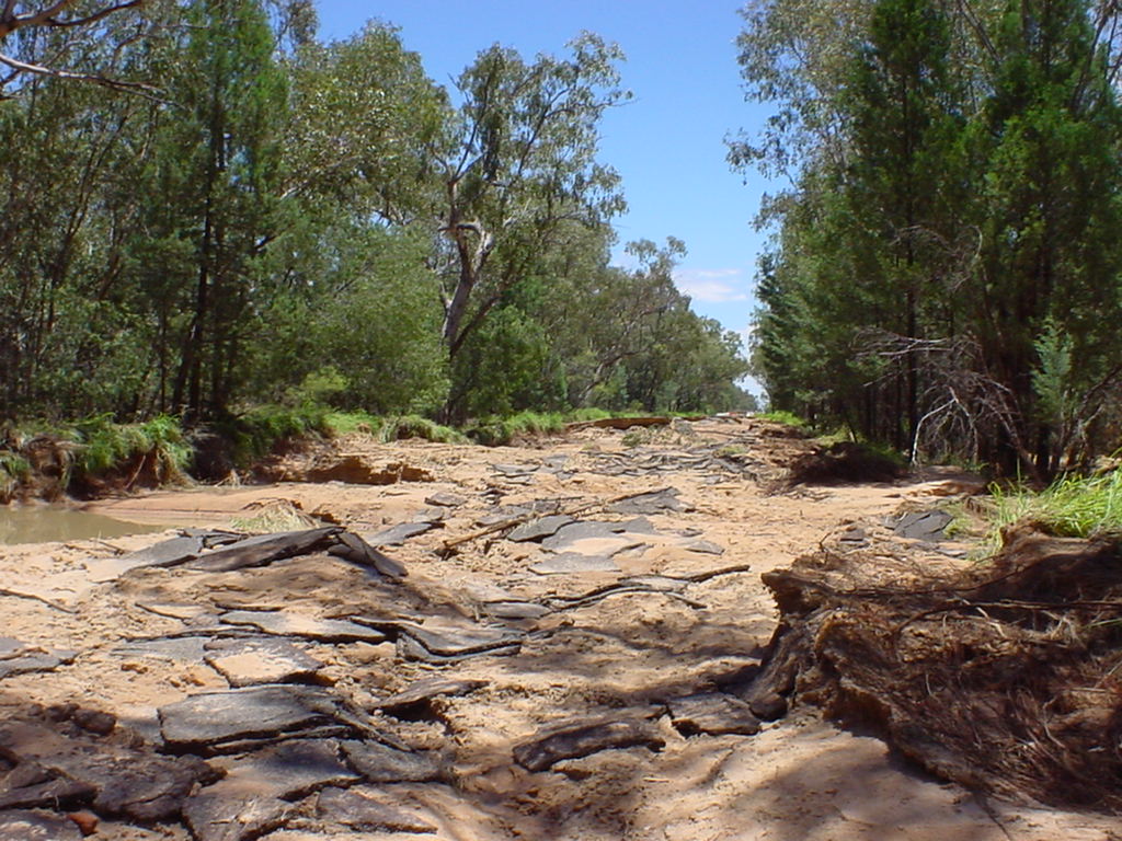 |
Nuable creek on the Yarrie Lake Road. Notice how large sheets of bitumen are still there but all of the road-base is gone from under it! Photo by David Brodrick. | 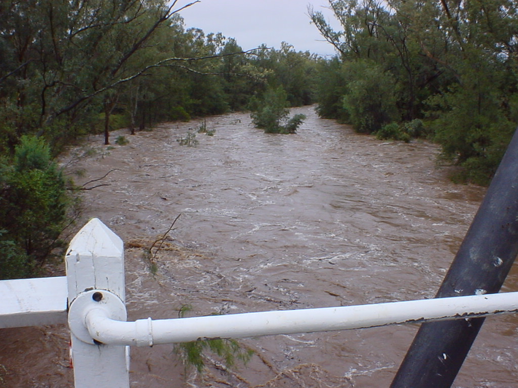 | A raging torrent of water descends from Mt Kaputar down Bullawa Creek. Taken at the Eulah Creek Rd turnoff. Photo by David Brodrick. |
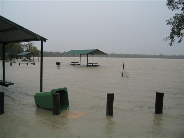 | Camping grounds at Yarrie Lake underwater. Photo by Andrew John. | 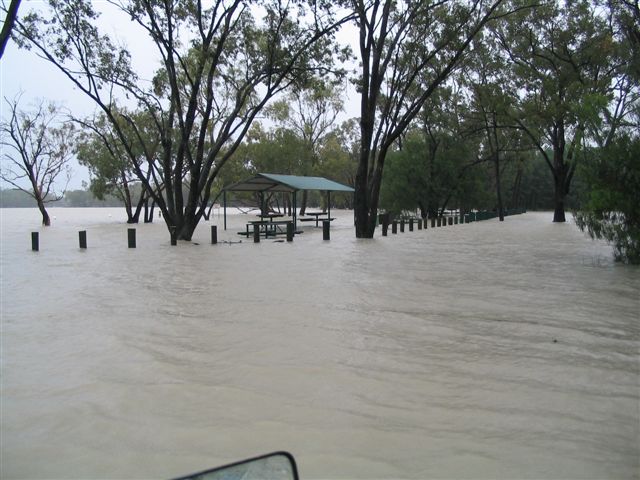 | Camping grounds at Yarrie Lake underwater. Photo by Andrew John. Andrew contributed "Once the Lake reached this level the Wee Waa entry road on the hall side of the lake was a 3ft deep discharge river". |
 |
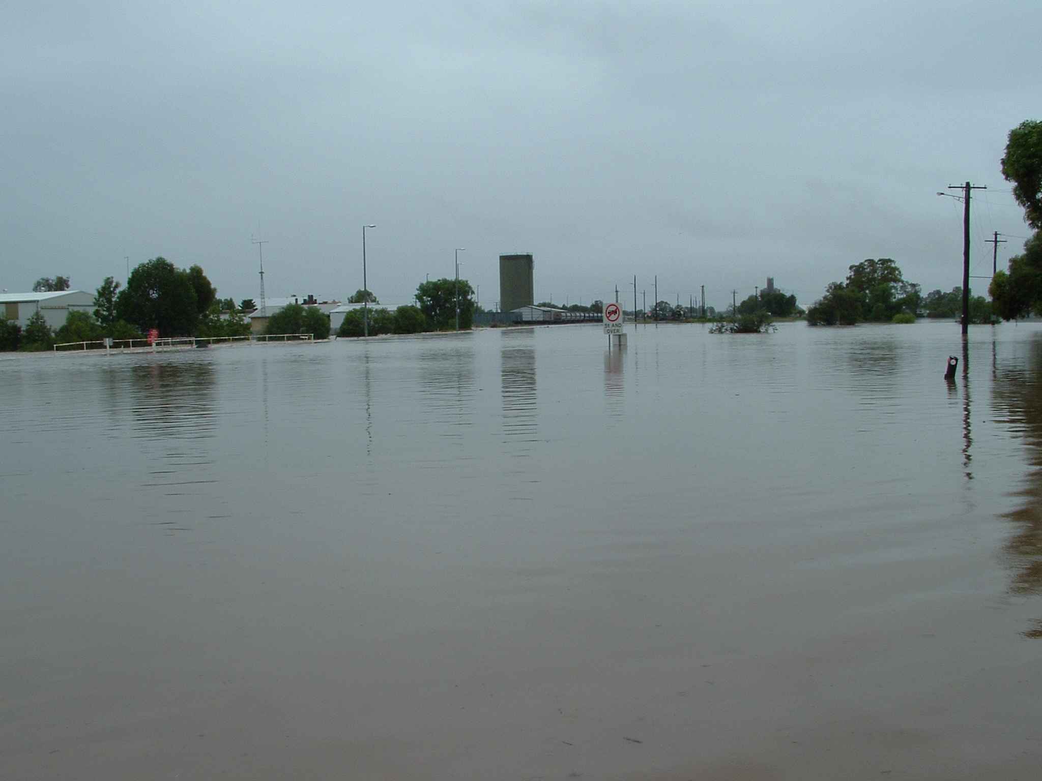
Flood waters rising near the railway bridge. Photo by Rose Roche. | 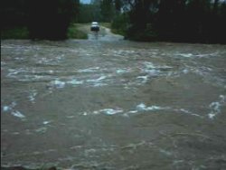 |
Movie! 32 second AVI (4MB) by Norman Webster. The flood water completely washed out the concrete causeway on Bullawa Ck. "They" say that Bullawa Ck is one of the fastest flowing creeks in NSW. |
 | Taken on Railway St(?) near the railway crossing close to Cargil. The railway line was badly washed out near the creek here. Photo by Tony Cox. |  |
Day's like this you wish you had a boat instead. Looking up Moolobar St from the Cargil end. Photo by Tony Cox. |